

PHYSICAL FEATURES OF THE BELFAST DISTRICT.
By J. St. J. Phillips.
-- -- -- -- --
THE term BELFAST DISTRICT has been taken as embracing the counties of Antrim and Down. It is included between the parallels of 54° 5' and 55° 15' N., and the meridians of 5° 25' and 6° 45' W. The county of Antrim contains an area of 190 square miles; the county of Down containing 956 square miles. Our district may also be referred to as the N.E. district of Ireland. It is bounded on the north by the Atlantic, and on the east by that portion of the Irish Sea known as the North Channel. Two watercourses also form the almost continuous boundaries on the west -- the county of Antrim being separated from the county of Derry on the west by the Lower Bann river, from the counties of Tyrone and Armagh by Lough Neagh. The county of Down is separated from the counties of Armagh and Louth by the Newry canal and Carlingford Lough.
The counties of Antrim and Down are separated from each other by the Lagan river and Belfast Lough.
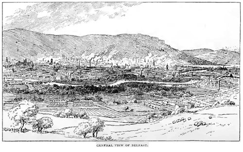
CONFIGURATION. -- The surface features of the two counties present many contrasts; and the student may find, in this small area, much that will repay his attention. By approaching the city of Belfast from the sea he will obtain a good preliminary survey of the contrasts in a comprehensive way. The county of Down presents a long coast line, backed at some distance by hills of little apparent elevation. Antrim, on the other hand, has generally the coast line dominated by steep escarpments, in places rising precipitously from the sea as bold promontories and headlands, or rising equally precipitously at no great distance from the present shore line. Inland is found a great plateau dipping gently to the west, covered with wide stretches of flat bog or deposits of glacial gravels and clays.
The streams flowing inland from the top of the Antrim plateau are sluggish and serpentine, but those flowing over the edge of the escarpment to the sea are short and rapid in their courses, carving deep valleys or notches in the edge of the escarpment. County Down for the most part consists of undulating hills of no great elevation, except in the extreme south, where the Mourne mountains rise to a height of 2,796 feet above the sea. In Down, the slope of the river-courses is more even, and as they flow into the sea they produce flats and become sinuous. These contrasts between the two counties are due to the difference in the nature and statigraphical characters and arrangement of the rocks of the respective counties. Both counties have been subjected to the same sculpturing and denuding agencies in recent times, notably to glacial action, and subsequently to the usual modifying action of aerial and aqueous denudation.
COUNTY ANTRIM generally may be considered as a land owing its rocks to the Mesozoic and Cainozoic eras. No great series of earth foldings or mountain building strains have occurred in the county since the deposition of its rocks. Numerous faults occur which may be traced to the Eocene period, but the efforts towards rock crumplings or mountain building proved abortive; the rocks of our district could not resist the strain; and the crust of Mesozoic rocks, represented by the Chalk, broke into a number of "floes," the black lava finding its way to the surface through the wider fissures, converting them into dykes. So rapidly and evenly did the Chalk yield under this strain that the original horizontality of its beds of deposition has been but slightly affected. The general surface of the county may be described as "saucer-shaped"; that is, the central area consists of a plain somewhat depressed below the level of the edge or escarpment that overhangs the coast line. This "saucer-shaped" character is mainly due to the Pliocene or Post-Pliocene movements, which broke up the old Derry-Antrim plateau and dropped the basalt to the level of Lough Neagh. The edge of the saucer or the escarpment presents a fine and almost continuous geological section, basalt occupying the higher portions, under which occurs the Chalk -- sometimes little more than a thin white line, but often of considerable depth, as at Glenarm and the White Rocks, near Portrush. In places, Lias underlies the Chalk; and as the Lias is semi-plastic in certain localities, as at Carnlough and Garron, it produces its effects on the landscape by causing numerous landslips. It is only in such slipped masses that the dip of the strata deviates much from the horizontal.
To this general statement there are, of course, exceptions. Numerous natural causes have been at work since the deposition of the basalt of the Eocene times to modify and mask the "plateau " character of the inland districts of Antrim, or to modify the regularity of outline of the basalt escarpment. The course of river development may be studied in the romantic and picturesque Glens of Antrim to the greatest advantage: there we find many examples which might serve as text-book illustrations of the progress and "life history of rivers," from the steep and rapid torrents that pour as waterfalls over the edge of the basalt escarpment to the older types which have eaten back their courses far into the basalt plateau
Again, on the western side of the county are to be found slow and meandering rivers winding among the glacial sands and gravels that cover the basalt plateau, finding an outlet sometimes in Lough Neagh, like the river Main, the Sixmile Water, and the Glenavy river; or, like the Lower Bann, flowing into the open sea with a fall of 48 feet in a course of 35 miles.
COUNTY DOWN. -- The county of Down consists, on the other hand, chiefly of rocks of the Ordovician era; the strata are much contorted by the great earth movements of post-Silurian times, so that it is difficult and often impossible to follow any given bed over any great area, or to draw a sharp dividing line between two beds of different ages. In a few places rocks of a later age occur, as in the Comber river valley, where Triassic rocks are to be found capped by a sheet of basalt, an outlier of the Antrim plateau; but these rocks still retain their original horizontality, and occupy a small area.
In the centre and in the south of the county are to be found two districts of mountainous character. Between Dromara and Castlewellan is found an outcrop of granite attaining an elevation of 1,755 in Slieve Croob, with other dominant elevations adjacent, notably Cratlieve, Slievenisky, and Slievegarran. These granite hills probably originated in latest Silurian times. Granite of the same age is also to be found at Goraghwood, near Newry, and at Castlewellan, to the west of Newcastle. It should be noted that the granite of Slieve Donard is of a much later age, probably owing its existence to the same plutonic disturbances that gave rise to the basalt of Antrim. The district of the Mournes attains considerable elevation, the dominant peaks being Slieve Donard (2,796 feet), Slieve Commedagh (2,512 feet), Slieve Bingian (2,440 feet), Slieve Bernagh (2,394 feet), and the two Slieve Meels. Most of the summits are dome-shaped, as is common with granite mountains, but some are crowned with crags and sharp peaks (hence the name, Slieve Bingian -- the mountain of the sharp peak).
COAST INDENTATIONS AND LAKES.
COUNTY ANTRIM. -- The coast of Antrim, while possessing no great bays (except the land-locked Larne Lough), is characterised by numerous sinuosities with intervening headlands. The bays on the east coast are the continuations of the valleys with their river courses which form the Glens of Antrim. The most notable are Cushendun Bay, at the foot of the Glendun Valley; Red Bay, at the foot of the Glenariff Valley; Carnlough Bay, and Glenarm Bay, at the foot of the Glenarm Valley. Larne Lough is enclosed from the sea by the peninsula known as Island Magee; the lough is about 6 miles long, and at its entrance to the sea is less than a quarter of a mile wide. Belfast Lough, the extension of the Lagan Valley, is 14 miles long and 7 miles wide at its mouth.
COUNTY DOWN. -- The chief indentations of the County Down coast are Strangford Lough, Dundrum Bay, and Carlingford Lough. Strangford Lough covers at high-water an area of 57 square miles. Much of it is too shallow for navigation, purposes, consisting of shallows and sloblands. A considerable area of this lough could be easily reclaimed, and already parts of it near Newtownards have been so treated. The entrance to the lough is about one-third of a mile wide and about five miles long. Here, at certain states of the tide, the current runs at from 5½ to 7 knots for ordinary tides to 9 knots an hour for some spring tides, generating whirlpools that are dangerous to boats attempting to enter the lough. We are led to suppose that its present outlet dates from the end of the Glacial period. Before this, its basin, from evidence found in the glacial deposits to the south of the district, seems to have been shallower than at present, containing a large deposit of Carboniferous limestone. The pre glacial entrance was probably situated between Ardglass and Dundrum. Between these points we find extensive deposits of glacial sands and gravels, with a large percentage of Carboniferous limestone erratics; and the district known as Lower Lecale, from Downpatrick to the east, bears evidence of extensive glaciation, the striae running N.N.W. and S.S.E.
The next coast indentation is Dundrum Bay, bounded on the north-west by extensive sand dunes. Carlingford Lough, nine miles long and about two miles wide, separates County Down from County Louth, and is bounded on either side by the steep slopes of the Mourne mountains and Carlingford mountains.
DRAINAGE AND RIVERS.
The county of Antrim possesses one main watershed, embracing the summits of the hills that occur parallel to the east coast. It follows the line of hills parallel to Belfast Lough in a N.E. and S.W. direction. The following are the chief peaks or eminences in the crest beginning from the north: Carnanmore (1,254 feet), overlooking Torr Head; Slieveanorra (1,676 feet), at the head of the Glendun river; Trostan (1,817 feet), Collin Top, Slemish (Slieve Mis, 1,437 feet), Agnew's Hill, Cave Hill (Ben Madighan, 1,188 feet), overlooking Belfast; Black Mountain and White Mountain, a few miles north of Lisburn. This line of summits deviates from the straight line, where the watershed has been eaten back by the rivers that have excavated the valleys forming the Glens of Antrim. To the east of it the rivers flow into the North Channel with steep and sometimes precipitous courses over the edge of the escarpment; to the west of this line the rivers find their way over the plateau that forms the greater part of inland Antrim towards the west. The westerly trend of these rivers, however, is modified by the presence of a ridge stretching from Dunloy to near Ahoghill in a north and south direction. The presence of this ridge parallel to the main watershed, running north and south, deflects the rivers from their westerly course, giving them a southerly trend till the valley reaches Lough Neagh. The river of the Lower Bann is the main artery from Lough Neagh to the sea. The Lower Bann has a wide drainage area: from the east it receives the drainage of the greater part of Antrim; on the west the water-shed of its drainage area extends to the Sperrin mountains and the range of hills that form the western limit of the basalt plateau which we have already met with in Antrim.
In the COUNTY OF DOWN the watersheds are harder to determine. One such is well defined; namely, that running from the Eagle Mountain (2,084 feet), in the Mourne range, to Slieve Croob, about six miles south of Ballynahinch. On the slopes of Slieve Muck in the Mournes, the river Bann begins its course, and flowing north enters Lough Neagh; the river Lagan has its source on the slopes of Slieve Croob, and after a winding course enters Belfast Lough.
ANTRIM RIVERS.
Having briefly pointed out the watersheds, we may now consider the rivers in detail. Beginning with those on the east slope of the watershed, we have the Glendun river, entering the sea at Cushendun; the Glenariff river, entering the sea at Red Bay; the Glenarm river. These rivers, though of little importance on account of the shortness of their courses, embosom in their valleys some of the most charming scenery in the county. The chief river on the western slopes of the main watershed is the Main. This river pursues a southerly course, intercepting on its way numerous tributary streams pursuing a westerly course from the main watershed; ultimately it enters Lough Neagh below Randalstown. The extreme north of Antrim (with the exception of a small area near Ballycastle) is drained by the Bush river. This river enters the sea below the town of Bushmills. The Lower Bann has been noted as forming the western boundary of the county.
RIVERS OF DOWN.
A number of rivers originate on the slopes on either side of the watershed found in the southern half of the county. To the east of the Mourne mountains are a number of small streams, such as the Kilkeel and Annalong rivers, with short and steep courses; while to the west the gradients are easier, the courses much longer, and the rivers attain to much more importance, the Upper Bann having a course 40 miles long, and the river Lagan a course of 38 miles.
In the "lowland" district north of the line between Hillsborough and Downpatrick, the following rivers are found flowing into Strangford Lough: the Quoile, Blackwater, and the Comber river; draining into the Lagan, the Ravernel and other small streams.
LAKES.
The most important of these is Lough Neagh; and being the largest expanse of fresh water in the United Kingdom, it is worthy of some consideration. It is about 14 miles long and 8½ miles broad, occupying an area of about 98,224 acres. It is bounded by five counties -- Antrim, Derry, Tyrone, Armagh, and Down -- each of which includes a portion of the lake. Though of such size, it is one of the shallowest of our British lakes, its average depth being less than forty feet. Soundings made in Lough Neagh reveal some interesting facts. A shallow margin extends around the shores. This margin is of considerable extent, and varies in depth from two to three feet; at the edge of this margin there is a sudden and steep depression, when the lake deepens gradually to a depth of fifty feet in the centre. Between Langford Lodge and Kiltagh Point, near the centre of the lake, occurs a well defined channel. This channel may be traced in a northerly direction for about twelve miles, attaining a maximum depth of 102 feet off Skady Island. Much has been written, much has been handed down by tradition, as to the origin of this lake. Some of the tradition has formed the subject of one of Moore's melodies. Many popular beliefs are still extant as to the wonderful "petrifying" and the medicinal powers of the waters of the lake. They are suggestive if not satisfying. According to the annalists in the first century of the Christian era, when Lughaidh was King of Ireland -- i.e., from A.D. 65 to A.D. 73 -- a fountain burst forth and continued to flow until it filled the valley now occupied by the lake. But if this valley existed with a bar at its lower end, as is at present at Toome, the question may be asked how it was that the depression was not filled with the waters that would flow into the basin from the rivers; that is, if these present rivers still flow in their ancient beds, and that the rainfall at that period was not less than at present. The alternative is that the depression did not exist before the reputed outflow, and that the formation of the lake was caused by the sinking in of the area now covered by the waters of the lake. The legend is just possible so far as it deals with the statement that the lake originated at this period in the history of Ireland, but further than this we need not place much reliance as to the cause ascribed by the tradition. It was much easier for the people of that time to observe the fact of the lake being formed, than for them to arrive at the correct cause of its origin; they would more readily notice that the waters were covering and encroaching on their valley, than that their valley was actually sinking below the bar level at the north end of the lake. We may sum up briefly some of the observations that have a bearing on the subject. A series of large faults occur in the rocks around this district, resulting in serious displacement of the strata: these, however, are common all over the plateau of Antrim, but need not necessarily have en used the depression in which the lake occurs, though the subsidence of the land may have occurred along these lines at a much later date.
The researches of William Swanston and Clement Reid are of considerable importance. These observers followed up the investigations of others who had found shells which they referred to the fluviatile genus Unio. These shells have been more recently dug out by Mr. Swanston in 1878 from Crumlin river beds, and found to be the common Mytilus edulis1 These occur in a dark blue mass of clay, which rests on true boulder clay, with numerous erratics derived from the boulder clay; hence the clays cannot be earlier than the Glacial period. The Mytilus beds point to the fact that the whole of the area was connected with the sea at some period subsequent to the Glacial period. A further point of interest is that, recently, the shrimp Mysis relicta has been taken living in the depths of the present lough. That the river systems of the country had been established before the subsidence which is now occupied by the lake, is suggested by the fact that a well-defined channel can be traced on the bed of the lake following the course that would have been taken by the Bann river before the subsidence of the ground at this portion of its course. From these evidences we are therefore led to conclude that the lake had its origin subsequent to the Glacial period. Popular tradition places it in the Human period, and it may not be improbable that the tradition is altogether without foundation. (See Sir Archibald Geikie's Ancient Volcanoes of Great Britain, vol. ii, page 448, et seq.) Silicified wood is found along the shores of Lough Neagh. Local peasantry attribute petrifying qualities to the waters of the lough; but as the silicified wood in question is found also in the boulder clays to the south and east of Lough Neagh, it would appear that specimens found on the shore have been derived from these beds, which, in turn, had found their supplies from deposits of the same age as the lignites of Ballintoy. Silicified wood has also been found in boulder clays at Armagh, indicating an abundant forest from which such widespread erratics have been derived.
The only other lakes calling for mention in the county of Antrim are Lough Mourne, four miles north of Carrickfergus, and Lough-a-veema, six miles by road, north-west of Cushendun. This latter lake is of interest from the existence of a subterranean channel which drains the lake into the Carey river.
In County Down a few lakes are to be found among the Mourne mountains. These lakes are dammed by moraine material, and evidently originated in the Glacial period.Numerous small lakes occur on the low grounds.
ISLANDS.
The most important island off the Antrim coast is Rathlin -- called by the natives Raghery; it figures on Ptolemy's map as Rechra. It is about six miles north of Ballycastle, and, geologically, is similar to the mainland of Antrim, which it also resembles in scenery: it contains about 3,400 acres. Between this island and the mainland a strong tide runs. This stretch of water was known as the "Moyle," and is referred to in an old Irish legend, and in Moore's well-known lines:
"Silent, O Moyle, be the roar of thy waters."
Off the coast of Down and in Strangford Lough are a number of islands of small size. The most noted are the Copeland Islands, off the north-east of Down.
STRATIGRAPHICAL GEOLOGY.
WE may claim for our district, with a considerable amount of justice, that it presents to the geologist, within its small area, a great variety of remarkable features and rock exposures which will prove well worthy of detailed study.
We find in our counties representatives of the four great eras. The Archæan period is possibly represented by the schists and gneisses of north east Antrim; the Palæozoic era is represented by the Ordovician and Silurian rocks of County Down, by the Old Red Sandstone near Cushendall, by an interesting patch of Carboniferous sandstone near Ballycastle, County Antrim, and by Carboniferous shales near Belfast. Just beyond the boundaries of our district Carboniferous limestones are found at Carlingford and in County Tyrone.
The Mesozoic era is represented by Triassic sandstones and marls at various localities from Newtownards to Murlough Bay, by the Jurassic rocks at the foot of the escarpment, from Colin Glen, near Belfast, to the celebrated Lias sections at Portrush, and by the Cretaceous rocks of Antrim.
The Cainozoic era is represented in Antrim by a remarkable series of basaltic and other igneous rocks, ranging from acidic series, as in the Mourne mountains granite, to basic series, as in the basalts of Antrim -- varying from the holocrystalline to glassy type in their respective series.
Of the Post-Pliocene times, our district presents many problems worthy of investigation in the varied phenomena of glacial geology. The estuarine clays and raised beaches bring us to a more recent period, and are rich in records which will assist us in our retrospective efforts to restore the geography of the land when first peopled by man.
The local representatives of the above-mentioned rocks present features somewhat interesting, as in many cases they are the remains of shore deposits, and the strata often are found thinning out as if they represented the deposits of ancient sea margins rather than of deep depressions.
ARCHÆAN (?) ROCKS.
In the north-east of Antrim, from Cushendun to Murlough Bay, the coast scenery differs from that we have first seen in our entry into the county from Belfast Lough. The basalt escarpment is no longer the characteristic feature of the landscape; instead, we find rounded outlines and rugged and uneven surfaces.
The rocks are schists and gneisses, much folded and crumpled, and so metamorphosed that it is now impossible to determine the origin of the series. To understand them, reference should be made to a good geological map of the British Isles, when it will be noticed that these rocks in our locality are but an exposure of an ancient ridge which appears in Ireland near Cookstown, in County Tyrone; the same ridge may be traced to the Mull of Cantyre opposite. In our district this ridge represents a watershed traversing in a north-easterly direction the peaks of Slieveanorra, Agangarrive, Crockaneel, and Carnanmore hills. To the north of this ridge the rocks dip towards the north-west at about thirty degrees, but this dip is subject to many local variations; to the south-east of the ridge the dip is towards the south-east. Similar rocks (lithologically) form another ridge in the highlands of Donegal. These two ridges are probably the results of great earth movements that took place at the end of the pre-Cambrian times: since then the rocks have undergone many further vicissitudes of elevation and depression, as well as surface weathering. The rocks, as we now find them, are mica schists and gneisses, with many local variations of character; in places, as at Torr Head, bands of black calcite occur four inches thick; here also the gneiss is altered into "augen gneiss," with rounded grains of quartz, the other materials seemingly flowing round and enclosing the quartz grains. In other places the schists are highly foliated, with an easy cleavage along the flattened micaceous planes, which glisten brightly on exposed surfaces.
In the neighbourhood of Torr the rocks are much faulted. In many places the beds are highly foliated and contorted; numerous veins of quartz occur traversing irregularly the planes of foliation. Reference to the Geological Survey sheets, Nos. 8 and 14, may be made. These two sheets include all the Archæan rocks exposed at the surface in this district. On the west the outcrop is bounded by a long fault, the position of which is closely followed for a considerable distance by the line of the Ballycastle railway. The mountain of Knocklayd, adjacent to this line on the east, is crowned with a capping of basalt, which allows us to arrive at a conclusion as to the downfall throw of the fault, by comparing its altitude with the level of the corresponding exposures on the west side of the fault.
Near Cushendall is found another boundary of the schist series. The line runs from Retreat station in Ballyemon Glen to Cushendun. To the south-east of this line are found the conglomerates of the Old Red Sandstone.
The southern boundary of the outcrop pursues an irregular line, along which occur Cretaceous beds capped with basalt. As to the age of the series, the only conclusion that can be arrived at, from local evidence alone, is, that the schists are pre-Devonian, as pebbles of the schist and numerous pebbles of quartz, apparently derived from the veins that traverse the schists, are to be found in the conglomerates of Old Red Sandstone age. That these pebbles are much rounded, and that so large a percentage of them are composed of hard quartz, would lead us to infer that a very considerable time elapsed from the formation of the schist series to the deposition of the rocks of the Old Red Sandstone period.
It is only by correlating the schists with the exposures of lithologically similar rocks occurring in the Mull of Cantyre, that we can gain any light as to their age; and in doing so, we are led to place our series among the "Archæan," between which and the overlying Devonian conglomerates we find in the north-east of Antrim no representatives of the Cambrian, Ordovician, or Silurian strata.
THE SILURIAN ROCKS OF THE DISTRICT.
Passing from the early rocks of the north-east of Antrim, the next representatives of the geological series found in our district are the Ordovician rocks of the County Down. Mr. Swanston, F.G.S., and Professor Lapworth have published the results of their investigations in the appendix to Proceedings of the B.N.F.C. for the year 1887; more recently, officers of the Geological Survey have gone over the ground, and the results arrived at are summarized in a Guide to the Collection of Rocks and Fossils belonging to the Geological Survey of Ireland, 1895.
These rocks are found widely distributed throughout the whole of County Down, and occupy the entire of the lowlands. Only on the slopes of the Mourne mountains are they to be found at any elevation, and their elevation there is due to the intrusion of a large laccolite of granite of much later age.
They extend beyond the limits of the county into Armagh, Monaghan, Longford, and Cavan, also into Louth and Meath on the south. Tracing the line of strike to the east, we find the same rocks occurring in the lowlands of Scotland; and in Mr. Swanston's paper above referred to the beds or zones in these two districts have been closely correlated.
Along the southern shores of Belfast Lough occur representatives of the Llandeilo and Lower Bala series; that is, the representatives of the Lower Silurian or Ordovician. Between Orlock Point and Donaghadee the rocks pass into the Llandovery series of the Silurian system; while still further south, near the extremity of the Ards peninsula, occur representatives of the Tarannon shales.
The Ordovician rocks of County Down and County Cavan are of the Moffat type, while to the north-west, in County Tyrone, they are of the Girvan type. In County Dublin and further south they are of the Lake District type.
As in the earlier rocks we trace a general line of strike for similar beds, so in the Ordovicians we may correlate the various rocks occurring in Ireland by tracing a similar north-east and south-west series of strikes, and comparing the Irish rocks with those of the neighbouring land of Great Britain. The Silurian rocks of County Down, as found at Coalpit Bay and at Tieveshilly, near Portaferry, correspond with the Birkhill and Gala beds of the south of Scotland in the graptolites which they yield.
In Swanston and Lapworth's paper above referred to, the conclusions there arrived at are summarized as follows:
"The Silurian rocks of County Down are, from the foregoing, proved to belong to several distinct divisions of the system.
"1st. The lowest, exposed at Coalpit Bay, the shales of Ballygrot, Craigavad, etc., are the representatives of the Glenkiln shales, the equivalents of the Upper Llandeilo of Wales.
"2nd. The black shales of Carnalea and the barren mudstones at Coalpit Bay represent respectively the Lower and Upper Hartfell series, the equivalents of the Bala or Caradoc.
"3rd. The black shales at Coalpit Bay, characterized by the zones of D. acuminiatus, D. vesiculosus, M. gregarius, and D. cometa, represent in part both the Lower and Upper Birkhill shales, which are paralleled with the Lower Llandoveries.
"4th. The grits and conglomerates which immediately succeed the latter are of the same age as the Bala series, and occupy a high place in the Middle Silurians.
"5th. The black shales and associated flags at Tieveshilly, near Portaferry, occupy either the extreme top of the Middle, or the base of the Upper Silurians, and are the highest Silurians yet recognised in the north-east of Ireland.
"The geographical relation of the area under consideration to that of South Scotland, and the general direction of the strike of the rocks in both districts, would naturally lead to the expectation of a certain degree of similarity between their geological characters. From the foregoing, however, it is clear that not only generally, but in detail, do they correspond in a remarkable degree. While it would, perhaps, be impossible, owing to the imperfect manner in which the fossil bands are exposed, to unravel the sequence of the various bed in County Down from an examination of them alone, the key afforded by the recent researches in the Scottish beds has made the subject a matter of ease. We are thus enabled for the first time, with some amount of certainty, to arrive at conclusions regarding the physical geology of the district. The three graptolitic shale bands and their associated mudstones have been overlaid by the grits and conglomerates so conspicuous in the county; all were folded into vast waves, the crests of which ran in the direction from about north-east to south-west.
"Subsequent denudation completely altered the contour of the district; and, judging from the remnants of Carboniferous strata at Castle Espie and Cultra, it seems to have been covered by rocks of that age, and to have been again upheaved and subjected to denuding agencies, which probably left it in almost its present state."
"The north-western boundary of the Silurian area has been subjected to the greatest amount of upheaval, and, as denudation has reduced all to a somewhat uniform elevation, the lowest beds are here consequently most exposed. The Ballygrot beds form the axis of what was the most northwesterly anticlinal; the black shales of Crawfordsburn, Carnalea, and Orlock Point possibly represent waves of minor importance; while that at Coalpit Bay seems to have been one of considerable elevation."
OLD RED SANDSTONE.
The only representative of the Devonian system in our district is found in a small area round Cushendall. The exposure extends from the caves at Cushendun to Ballyemon Glen, a distance of six miles -- the greatest width being three miles. No fossils have been found in the rocks in this district, but on general lithological grounds they have been referred to the Old Red Sandstone, being considered as remnants of the Lake Caledonia basin. On the north-east boundary of the exposure the rocks are found resting on the Archæan schists, and on the south-west they are covered by beds of Triassic age. Finely exposed sections occur along the shore from Cushendall to Cushendun. At the north-end of the exposure at the caves at Cushendun, the rocks consist of a coarse conglomerate with intermediate sandy strata; the pebbles are composed chiefly of large and rounded blocks of quartz and schist that have been derived from the ancient Archaean ridge to the north-east; the matrix in which these pebbles occur is highly silicious; the whole mass, after consolidation, has been subject to considerable crushing and shearing; the hard quartz blocks often are found split into several slices. So thoroughly does the matrix cement the various materials, that, in the face of the shear plane, the fracture passes through the quartz block rather than dislodges it out of the matrix. The strata are much broken and displaced by small faults and dislocations, on the face of which these features can be clearly seen. In the exposures of this rock near Cushendall, the rock is less coarse in the character of its contained blocks, and a greater percentage of pebbles of quartz porphyry occurs. Still further to the south, in Ballyemon Glen, the rocks become more sandy; good sections of the beds can be seen in the stream to the north of Retreat station, and at this point their relations to the underlying and overlying beds can be well observed. The general strike of the beds is N.E. and S.W., and the dip varies from 30 to 60 degrees south-east, according as the dip has been modified by local dislocations.
CARBONIFEROUS SYSTEM.
LOWER CARBONIFEROUS SANDSTONE. -- Rocks of this age are found exposed in the neighbourhood of Ballycastle, in the north of Antrim, where the series is represented by thick sandstones, shales, coal seams, thin limestones, and ironstones. In character, the rocks of this district differ from the Lower Carboniferous series in the central plain of Ireland, and have been correlated with those of the west of Scotland; their appearance has also been likened to the colliery of Burdie House, near Edinburgh. On this account they have been referred to as Calciferous Sandstone. Professor Hull states: "The series in County Antrim belongs, in all probability, in part to those of the 'Upper Calciferous,' the 'Carboniferous Limestone,' and the 'Yoredale' stages of Scotland and the North of England; and amongst the points of analogy are the occurrence of thick beds of red and yellow sandstones, of black band ironstone, and of earthy limestone in thin beds, containing marine fossils. These beds, only a few feet in thickness, are the meagre calcareous representatives of the great limestone formation of the central plain of Ireland, which has undergone a remarkable change in mineral characters and thickness in this direction, in keeping with the general change which the formation undergoes throughout the British Isles."
The Ballycastle coalfield was considered by Sir Richard Griffith as one of the oldest in the British Islands. In 1770, in pushing forward an adit towards a bed of coal, the miners struck an old working of considerable extent, which branched out into thirty-six chambers. The antiquity of this early working was such that even tradition had nothing to say of it, though the passages indicated very extensive workings in early times. The sides and roofs of the passages were covered with sparry incrustations, and in places the remains of old implements and decayed baskets were found.
Many attempts have been made to develop a trade in connection with the Ballycastle coalfield, but no effort has yet seemed to have succeeded in establishing itself on a successful and permanent footing.
The coal-bearing strata may be divided into three districts: (1) Colliery Bay, extending from Ballycastle to Carrickmore dyke; (2) Fair Head and Murlough Bay district; (3) the Glenshesk and Carey river district. Each district is divided from the others by dykes, while a number of faults traverse each coalfield. The Great Gaw dyke, stretching from Ballycastle to Murlough Bay, separates the first and third districts. The Carrickmore dyke separates the first and second districts. In the first district the sandstones are generally yellowish; in the second district the sandstones are thicker bedded and reddish, with a bed of purple limestone, and are capped by the dolerite of Fair Head, which has also intruded as sills into the sandstones; in the third district the prevailing beds are shales, with thin seams of coal and limestone; but in this district the rocks are generally covered by glacial drifts and gravels.
Owing to the number of faults and dykes, the dips of the beds vary in the different sections, and the numerous displacements have interfered with any extended efforts being made to develop the natural resources of the district. The thicknesses of the coal vary in the various districts from a few inches up to six feet. In the Salt Pans colliery, coal varying from six to nine feet was found about forty yards below sea-level.
The Murlough Bay colliery contains six coal seams, four of which are bituminous: two of these, known as the White Mine and Good Man's Vein, are two feet six inches thick.
The sandstone of the Ballycastle district has been used locally as a building stone with success; and if the beds are carefully selected, a durable building stone may be obtained. The weathering properties of the stone may be seen in the Boyd Church, Ballycastle, built in 1756; in some of the old tombstones at Bonamargy Abbey; and in many of the local fence walls.
Many fossils are recorded from the Lower Carboniferous rocks of Ballycastle. Plant remains are particularly numerous -- Sigillaria and Stigmaria. Sphenopteris flabellata is recorded from yellow ochreous shales at Fair Head. Lingula sguamiformis is abundant in the shales, while the limestones yield fish remains referred to Ctenacanthus and truly marine types of shells.
At CULTRA, on the southern shores of Belfast Lough, there is a small outcrop of Lower Carboniferous shale, dipping north about 20º. These rocks have yielded numerous specimens of Modiola MacAdami in the darker shales, while numerous fish remains, chiefly scales of Holoptychius Portlocki, have been obtained from the more massive beds of lighter-coloured limestone near the battery wall. A line of fault, running north and south, bounds the rocks on the west, separating them from Triassic sandstones; while to the east the rocks are, or were, covered by Permian. These Permian beds are, however, only to be observed at low ebb tide.
CASTLE ESPIE. -- Further south, at Castle Espie, near Comber, is found an exposure of Carboniferous limestone, resembling closely the Carboniferous of the central plain of Ireland. The rock rests unconformably on the Silurian, and has a considerable dip. Extensive lime-works were started here about thirty years ago, but at present operations are not being carried on, and the fine sections at one lime exposed in the quarries are now covered with water, and much of the rock in the district is covered with boulder clay. That the Carboniferous limestone covered a considerable area of the adjoining Strangford Lough seems to be indicated by the numerous erratics of Carboniferous limestone found in the boulder clay to the south of this locality. The rock surfaces also, when cleared of their covering of boulder clay, exhibit well-marked glacial stride.
The fossils obtained, when good sections were exposed, were of remarkably large size. Productus giganteus, Actinoceras giganteum, Athyris ambigua have been recorded.
Another small patch of Carboniferous limestone occurs at Cranfield Point, the most southerly point of County Down. It is evidently a continuation of the fine development of marine Carboniferous limestone found on the opposite shores of Carlingford Lough.
TRIASSIC SYSTEM.
Rocks of this age occur in both Antrim and Down. They form the basement rock of the Lagan valley from Belfast to Waringstown. They are widely exposed along the north shores of Belfast Lough, where they are lost under the sea on one hand, but extend right up to the foot of the basalt escarpment, giving rise to gently undulating uplands. On the south shores of Belfast Lough they extend as far as Cultra, and are there found resting unconformably on the edges of uptilted Lower Silurians. A wide belt of Trias extends from Belfast down the Dundonald valley to Newtownards and along the shores of Strangford Lough to Greyabbey.
The Trias in this district has representatives of the Lower Trias or Bunter, and the Upper Trias or Keuper.
BUNTER. -- The English Bunter has been subdivided into upper variegated sandstones, pebble beds or conglomerates, and lower variegated sandstones.
From lithological similarity, the sandstones of the Lagan valley have been referred to the upper variegated sandstones of Bunter age; the pebble beds of the English series as found in Cheshire not being found in our district, unless we may refer certain beds mentioned by the officers of the Geological Survey occurring near Beechmount as belonging to this subdivision.
Sections in the Bunter sandstone are to be seen in many localities near Belfast; notably, along the Shore Road, ripple-marked sandstones occur at the brickworks (Skegoniel Avenue) and at Fortwilliam Park; on the shore at Whitehouse and Macedon, in the County Antrim; while in the County Down a fine section may be seen at the now disused quarry near Dundonald.
The beds consist of soft bright red and yellow variegated sandstones, sometimes false bedded. These beds merge insensibly into beds of very similar character that have been referred to as belonging to the Keuper series of sandstones, red, white, and purplish, without any intermediate basement conglomerate.
KEUPER. -- The Keuper Sandstone is admirably exposed in the quarries on the sides of Scrabo Hill, near Newtownards. Here the beds are frequently ripple-marked, or show suncracks, and occasionally rain pitting, with the lucidity of a text-book diagram. Frequent layers of clay separate the massive beds of sandstone. False bedding is to be frequently observed, particularly in the sides of the rock faces of the passage leading into the main quarry to the south of the hill. The rock is extensively quarried for building stone, and, if carefully selected, yields an excellent building material for local use, for which there has always been a large demand.
The preservation of the Triassic strata at Scrabo is due to the protection afforded by the capping of Tertiary basalt. The various sections show, in a remarkably distinct manner, dykes and sills of the intrusive basalt. In the north quarry the sills can be seen branching from the vertical dyke; they can be traced and followed for considerable distances, sometimes following the bedding planes of the sandstone, and at times breaking through them for short distances to renew their horizontal course again for a time. In the south quarry a dyke about seven feet wide can be seen breaking through two such sills, and ultimately through the basalt capping overlying the sandstone. For the student of physical geology there are few places that can excel Scrabo Hill in furnishing, in a limited space, so many illustrations in situ of the principles of his science.
KEUPER CLAYS occur at various localities near the flank of the escarpment along the shores of Belfast Lough, and at an elevation of 150 feet near Woodvale Park, on the western side of the city of Belfast. The beds consist of thick red marls with bands of grey marls and thin sandstones. In places the marls attain a thickness of 800 feet. Numerous bands of gypsum occur irregularly through the mass; some of these bands, as found on the Forth river, being six inches in depth. These bands are well exposed on the railway cuttings beyond Kilroot and Cloghan Point, and also occur on the shore at Waterloo, north of Larne Harbour, where the marls and sandstones merge into the Rhastic series.
ROCK SALT occurs in considerable abundance in the Keuper marls at Carrickfergus and Magheramorne, and several mines have been opened at Duncrue, Eden, and Ballycarry, from which large quantities of rock salt have been exported. The section of the Duncrue mine is as follows:
| Feet | Ins. | ||
| 1. | Drift | 50 | 0 |
| 2. | Red marls with gypsum | 500 | 0 |
| 3. | ROCK SALT(ist bed) | 15 | 0 |
| 4. | Salt and blue band | 6 | 8 |
| 5. | ROCK SALT (2nd bed) | 88 | 0 |
| 6. | Blue and red band with some salt | 17 | 0 |
| 7. | Mixed salt, blue and red band | 13 | 0 |
| 8. | ROCK SALT (3rd bed) | 39 | 0 |
| 9. | Thin blue bands | 6 | 6 |
| 10. | Dark-coloured rock | 4 | 0 |
| 11. | Freestone | 10 | 1 |
| 12. | Grey rock (not pierced through) | 2 | 4 |
| 751 | 7 |
At Eden the thickness of the bed of rock salt is ninety-six feet; of this about fifty feet is kept intact to form the roof, and the lower portion is worked, leaving large pillars to support the roof. Some of the beds are very pure, containing from 95 to 98 per cent, of pure salt of commerce.
THE JURASSIC SYSTEM.
This system is represented in our counties by the lower formations only, while the Oolites are entirely absent. Our counties may claim to be unique in this respect, that it is only here that the Jurassic is represented in Ireland at all. As it is of interest to know what is absent as well as what is present, the table subjoined will accomplish this in the most comprehensive manner.
| OOLITE FORMATIONS. | |||
| Upper or Portland Oolite | { Purbeck Beds { Portland Beds { Kimmeridge Clay |
} } } |
Absent |
| Middle or Oxford Oolite | { Corallian { Oxfordian |
} } |
|
| Lower or Bath Oolite | { Great Oolite Series { Inferior Oolite |
} } |
|
| LlASSIC FORMATIONS. | |
| Upper Lias | Absent. |
| Middle Lias Lower Lias Rhætic or Infra-Lias |
} } Present. } |
The Rhætic and the Liassic beds of the north-east of Ireland attracted the attention of the late Professor Ralph Tate (the father of Naturalists' Field Clubs in Ireland), and his work on these beds is still our chief authority on the subject. His papers on these rocks were published in the Quarterly Journal of the Geological Society, vol. xx, p. 103; vol. xxiii (1867); vol. xxvi (1870). The Rhætic and Lias crop up in many places along the edge of the Antrim escarpment, but the following localities will be found most worthy of study: Colin Glen, Cave Hill, Barney's Point, Island Magee, Waterloo (one mile to the north of Larne on the shore), north of Garron Point in numerous landslips, White Park Bay, and Portrush.
A description of the section exposed at Waterloo will give an idea of the beds. Proceeding along the shore from Larne Harbour station, we pass over sands and gravels till we come to the shore entrance of Drumalis; between this and the bathing-box an exposure of Upper Keuper marls is to be seen below high-water mark; in places covered with gravels; the rocks are decidedly red in colour; north of the bathing-box they are cut through by a dyke, near which bands of gypsum may be observed in the marls. At the ladies' bathing-place the marls are blue-grey, again altering to red. The red stone is mottled with circular blue patches containing a hard nucleus. The footpath terminates against a cliff, in which a gradual transition to the White Lias or Rhætic can be traced. On the shore below Mr. Chaine's grave, thin bands of black shale occur with Axinus; the next band of shale yields numerous specimens of Ammonites planorbis, and the following band (about four inches thick) is crowded with Ostrea liassica. Passing the limekiln to a small bay, just south of some cottages on the shore, fine specimens of Lima gigantea may be found weathering out of blue Lias, while in the face of the bank above high-water mark a band of Lias yields numerous specimens of Gryphæa incurva.
Other localities will be visited to fill up our information on these beds: for instance, the Rhætic exposed in the stream at foot of upper Colin Glen will yield many fish remains, teeth and scales -- Gyrolepis and Saurichthys apicalis. Tate's measurements of the sections at this place are:
2. Dark-coloured shales and argillaceous limestones, with a few beds of sandstone at the base. In the shales are found Axinus cloacimus, Avicula contorta, Cardium rhæticum, Pecten valoniensis, etc. Thickness, eleven feet.
1. Black shales and clays, arenaceous shales, thin sandstones. In two of the thin arenaceous shales are fish remains -- Natica Oppelii, Trochus Waltoni, Avicula contorta. Thickness, eight feet.
In the Lias of Barney's Point, vertebrae and bone referred to Ichthyosaurus are occasionally found. Robert Bell recently found the skull of an Ichthyosaurus in the Lias on the east shore of Island Magee. The Lias of Barney's Point is an argillaceous limestone, which readily alters on exposure to water into a tenacious blue-grey mud. In this mud many perfect specimens are found excellently preserved; notably, such common forms as Cardinia Listeri and C. ovalis; sections of ammonites, as A. communis and A. Johnstoni, are common; the sand in places is largely composed of fragments of Pentacrinites.
Frequent exposures of Lias are to be found along the coast road, where the plastic nature of the rock has given rise to many landslips in the past, of which a noticeable example is the slipped plateau on which Garron Tower stands. After every storm of rain small local slips may occur, so that in places the road is often rendered impassable in winter, particularly between Carnlough and Glenarm, and around Garron Point.
In White Park Bay, beds of Middle Lias occur (Ballintoy beds), containing Ammonites Henleyi, Belemnites umbilicatus, Plicatula spinosa. Occasionally sections of the Middle Lias may be found exposed along the banks of the small stream, but usually the strata are obscured under surface slips. The storm of 1896 stripped the sand from the shore in White Park Bay, revealing the basement of Lias over a considerable area.
At Portrush, beds of Lower Lias occur on the shore near the ladies' bathing place. This rock has a classic reputation, as it was one of the arguments adduced by the Neptunists, about 1799, to prove the aqueous origin of the basalt. The rock is a dark indurated shale, breaking with a conchoidal fracture, frequently across the planes of lamination, so that in hand specimens it was easily mistaken for basalt. It contains, however, numerous fossils -- chiefly ammonites -- along certain zones, but these are very difficult to extract, owing to the splintery nature of the rock. Similar rocks are to be observed in The Skerries, a small group of islands off the coast at Portrush. The unusual character assumed by the Lias in these localities is due to the hardening and baking produced by the neighbouring masses of basalt and dolerite.
Only the Lower and Middle beds of the Lias are represented in Ireland, the Upper Lias being absent; but it is interesting to note that, among Lower and Middle Lias species occurring as derived fossils in boulder-clay in Co. Dublin, Messrs. Sollas and Praeger found one species of characteristic Middle Lias age.2
THE CRETACEOUS SYSTEM.
The rocks of this system are a very remarkable feature around the edge of the Antrim escarpment. In places the white chalk forms the strongest contrasts with the black basalt capping, and in other places, when found in juxtaposition with the red sandstones of the Trias, the colour contrasts are almost equally remarkable. Again, much of the variety of the scenery along the Antrim coast road is due to the faulting and slipping down of the strata, by which means the black basalt at times would seem, to the casual observer, to be interstratified with the chalk, as well as penetrated by the vertical dykes of black basalt which, in Eocene times, found numerous vents through long fissures in the white chalk.
The line of division between the basalt and the Chalk is so strongly defined as a horizontal line that any break in the continuity of that line is extremely noticeable. The frequency of such breaks strongly calls our attention to the numerous dislocations and fissures to which the crust of earth has been subjected in post-Cretaceous times; so that the county of Antrim is an admirable district in which to study the leading facts of dynamical geology. In some localities certain beds are absent which are prominent in others, suggesting investigations in the differential movements of the crust prior to the deposition of the Cretaceous rocks, or may allow us to reconstruct the hollows and heights of the ancient geography of the district in late Jurassic times. In close proximity to Belfast, on the slopes of Squire's Hill, the following divisions of the Cretaceous system in descending order are to be observed:
5. White chalk.
4. Glauconitic chalk, or basement bed of white chalk.
3. Glauconitic sands and sandstones.
2. Yellow sands, grey marls, and sandstones.
1. Glauconitic sands.
The correlation of these beds with those in England and the Continent is shown in the annexed table:
| CONTINENT. | ENGLAND. | IRELAND. |
| Danian | Absent | Absent |
| Senonian | Upper white chalk, with flints | White chalk (5)Glauconitic chalk (4) |
| Turonian | Chalk, without flints | Absent |
| Cenomanian | Lower grey chalk Chalk marl Cambridge green-sand | Glauconitic sands (3) Glauconitic sands (1) |
| Albian | Gault | Absent |
The GLAUCONITIC SANDS consist of a blue-green rock, rich in glauconite, showing evidence of having been formed in the interior of foraminiferal shells. In the Squire's Hill sections they preserve a uniform thickness of about five feet. The sands are characterized by Exogyra conica; other fossils found are Lamna appendiculata, Belemnites ultimus, Exogyra lævigata, Pecten orbicularis, P. quadricostatus, and Ditrupa deformis.
The YELLOW SANDS consist of buff-coloured calcareous sandstones, with chert masses and layers of soft brown sandstone, becoming at the base black and shaly. Fossils are fairly plentiful and in good preservation -- Ostrea carinata, Exogyra lævigata var. plicata, Pecten nitidus, Rhynchonella latissima, Cardiasler ananchytes.
GLAUCONITIC (so-called CHLORITIC) SANDS AND SANDSTONES. Dark green sands, almost made up of grains of glauconite; at the base of the section almost black; fossils are found, such as teeth and vertebrre of fish -- Exogyra columba, Ostrea semiplana, O. carinata.
GLAUCONITIC (so-called CHLORITIC) CHALK, the Basement Bed of the White Chalk, presents an interesting deposit of hard green chalk, with pebbles of quartz and large grains of glauconite scattered throughout the bed. Its fossil contents are chiefly sponges, with bands of Ananchytes ovatus. This interesting bed is evidently derived from the waste of an older bed containing large pebbles of rounded quartz, and characterized by an abundant fauna, chiefly fragments of cephalopoda, urchins, and sponges. The following are a few species noted: Belemnitella mucronata, B. quadrata, Pleurotomaria perspectiva, Echinocorys vulgaris, Holaster lævis, Ventriculites gibbosus, and Etheridgia mirabilis.
The Chalk is a pure white limestone, with frequent bands of flint lying in flat tabular masses along apparent bedding planes; in some exposures vertical masses of flint of a roughly columnar appearance are to be seen -- referred to as "Paramoudras."
The following is an analysis of the chalk from Magheramorne, by Dr. Hodges:
| Carbonate of lime | 98.63 |
| Carbonate of magnesia | 0.38 |
| Phosphate of lime | 0.10 |
| Oxide of lime and alumina | 0.08 |
| Silica and insoluble clay | 0.45 |
| 99.64 |
The analyses published by Dr. W. Frazer Hume may also be referred to.
The chalk, as found in our district, is hard and compact, breaking with a splintery fracture, so that even hand specimens are somewhat difficult to dress; planes of bedding are not very evident, except where emphasized by the tabular flints. Fossils are not very numerous, with the exception of Belemnitella mucronata, which is found widespread throughout the district. The other forms are Turritella unicarinata, Trochus sp., Ostrea vesicularis, Terebratula carnea, Rhynchonella plicatilis. Occurring mainly in the lower portions of the limestone are Mosasaurus gracilis, Echinocorys scatatus, Holaster planus, Pleurotomaria perspectiva, etc. Microscopic sections of the chalk reveal the presence of a large number of foraminifera. The chalk powder found in the interiors of many of the paramoudras and nodular flints is a fruitful source of well-preserved foraminifera, and also of siliceous sponge spicules and ostracoda. The Appendix iii. to the Proceedings of the Belfast Naturalists' Field Club. 1875, may be referred to for "A List of the Cretaceous Microzoa of the North of Ireland," by Joseph Wright, f.g.s., also the Appendix to the year 1884-85.
The chalk has been much indurated by the basaltic flows of Tertiary times. In some places, where in contact with the sides of a basaltic dyke, it presents a crystalline structure, and is often stained a light ochreous colour.
THE TERTIARY PERIOD.
After the deposition of the Cretaceous rocks, our district underwent a period of elevation. The bottom of the Chalk sea was elevated and became dry land, subject to sub-aerial denudation. Consequently, the upper surface of the Chalk is found to have been weathered, the softer calcareous material has been washed away, leaving many flint nodules embedded in an ochreous clay as an evidence of the amount of denudation which the Chalk has been subjected to before the outflows of basalt. This red ochreous material might well be compared with beds of similar character which occur in many parts of the country between the various basalt flows. An excellent example may be seen in the old chalk quarry at Whitehead, where the irregular form of the upper surface of the Chalk seems to indicate the sides of an old river valley. The flints are of a deep red colour, induced by the heat of the thick, deep lava flow. The only fossils recorded from this band are redeposited Chalk fossils. Over this old land surface numerous sheets of basic lavas were outpoured in early Tertiary times. During the periods of quiet, between the successive outflows of igneous material, the surface of the lava flow was subjected to denudation, a scanty soil was formed, vegetation got a footing, only to be submerged in the next flow. Remains of such vegetation are to be found in a well-defined band forming the division between the lower and the upper basalts. The band consists of volcanic tuffs, clays, conglomerates, thin lignites, and pisolitic iron ore. At Ballypallidy this seam has yielded abundant remains of plants -- Pinus, Salix, Populus, Acer, Quercus, etc. At Ballintoy lignites are found.
Mr. Starkie Cardner considers these remains indicate the same horizon as the Bournemouth beds; that is, they belong to the middle Eocene period.
THE PLEISTOCENE PERIOD.
GLACIAL DEPOSITS. -- Our district presents many problems for the glacial geologist. Boulder clay is widely distributed over the surface of the country. Fine sections of these clays are exposed in the numerous brickfields around Belfast. The clay rests upon intensely glaciated rocks; the Cretaceous rocks of Antrim and the Ordovician shales of County Down retain the polishing and scoring in great perfection. The division into upper and lower boulder clay, with the intermediate sands and gravels, is not always apparent; often only one division being visible. The clay is typically red, tough, unstratified, and laden with erratics well rounded and scored, of all dimensions, from great blocks of chalk and basalt down to tiny pebbles, which have often travelled long distances from their parent locality.
Sections of Boulder Clay overlain by Consolidated Sands and Gravels Glacial Striæ on Rocks in foreground.
In different districts the texture varies considerably, some clays containing a good deal of sand, probably derived from the Trias. Interesting deposits of stratified sands and gravels are numerous in the Dundonald valley in County Down; even more extensive deposits are to be found at Antrim, Killagan, and the Carey river valley in the County Antrim. The study of boulder clay and erratic blocks has occupied the attention of members of the Belfast Naturalists' Field Club for a considerable period, and the footnote gives references to their publications on the subject.
Scotch erratics are fairly common in our drift; the fragments of riebeckite eurite from Ailsa Craig (?) are almost ubiquitous. Many igneous rocks of Antrim are easily identified, and have furnished valuable evidence of the direction of ice-flow, generally from N.E. to S.W.
Some of the erratics from Antrim are of considerable size, such as the "Butterlump" Rock, on the shores of Strangford Lough. Shells occur occasionally in our glacial deposits and usually in broken fragments, except in a few places, such as Woodburn, where the valves of the delicate Leda were found still in juxtaposition. Foraminifera and other marine microzoa have been found in clays at considerable altitudes above sea-level; at 450 feet on Carnmoney Hill and the Knockagh; 800 feet at Wolfhill; and in two interesting little patches of stony clay at heights of 1,100 feet on the Cave Hill, and 1,300 and 1,400 on Divis Mountain. It is noticeable that these two last beds apparently contained no far-travelled erratics, basalt, chalk, and flint fragments only being found in them.
The close of the Glacial period leaves its records in many eskers and in the local moraines of the Mourne mountains, where these moraines have blocked up the ends of the valleys, producing lakes, which in time may have got filled up, giving us such flats as are found in the Happy Valley. At the foot of many valleys of the Mournes the glacial drift has been spread out as a fan talus, as in the valley above the Bloody Bridge.
Raised Beaches are common features along our coast at varying heights. Occasionally the old sea-cliffs and sea-stacks may be distinguished. Mr. Praeger considers that the raised beaches and the upper estuarine clay are contemporaneous.3
{ Raised beaches.
{ Upper estuarine clay.
Lower estuarine clay.
Submerged peat.
Sands and gravels.
Boulder clay.
ESTUARINE CLAYS are found under much of the low-lying area of the city of Belfast. The various works done by the Harbour Commissioners have exposed thick beds of these clays. In their lower portions they are of a littoral character, but in the upper portions are found many shells which live in depths of five to ten fathoms. These clays have yielded an abundant fauna, many of the species attaining remarkable dimensions. The deposit is a tough blue clay; under water it readily becomes a pasty mud; so that in the city, where the clay occurs, piles about forty feet long have to be used in forming foundations.
Similar deposits are found in Larne Harbour, notably at Magheramorne, and in almost all the bays in the north-east of Ireland.4
The peat bed contains remains of the Great Irish Deer, well-preserved plant remains, such as hazel, alder, oak, sedges, etc., and elytra of beetles. Resting on the peat is the lower or Scrobicularia zone of the estuarine clay, with a littoral shell fauna; the upper estuarine clay deposited in deeper water yielding Thracia convexa.
The sands and gravels of the Lagan valley are in many cases redeposited glacial deposits, owing their present position to the damming up of the drainage systems at the close of glacial times. Near the Ormeau Bridge fine sections have been exposed in the Annadale and other brickworks, while the eskers at Lisburn are the remains of englacial deposits contemporaneous with the gravels and sands of the valley above noted.
The alluvial deposits of the river Bann yield diatomaceous earth in large quantities at Toome and at Portglenone. The kiesulguhr works of Mr. Grant at Toome are of considerable interest and importance. Diatomaceous earth is also found at Lough Mourne, above Carrickfergus. Shell marls are found in various localities, as at Ballyfinder, near Portaferry.
Occurring under Sand Dunes, in which are found Flint Implements, Kitchen Middens, and Primitive Pottery.
Extensive sand dunes are found at Portrush, Bushmills, White Park Bay, in County Antrim, and at Newcastle, and around the shores of Dundrum Bay, County Down. These dunes and the raised beaches are among the archaeologist's hunting-grounds for the remains of primitive man: kitchen middens, old refuse heaps of shells, bone and charcoal, pottery, flint implements, flakes and cores, are of frequent occurrence in these localities.
Bogs are widely distributed over the higher grounds of Antrim; and associated with the bogs the remains of old lake-dwellings, or crannoges, are not infrequent. Some of these have been systematically explored, with the result that stone and bronze implements, glass beads, bronze and even gold ornaments have been unearthed. Many of these objects, alas ! find a final resting-place, like Irish exiles, far from home, instead of in well-organized local museums.
IGNEOUS ROCKS.
THE province of Ulster is extremely rich in the variety of igneous rocks which it contains; our counties of Antrim and Down presenting many problems worthy of the petrologist's attention. In Antrim extensive lava flows of Tertiary age cover most of the plateau. The outpourings of this period are not confined to the basic types alone; the acid type of igneous rock is also represented by the rhyolites of Tardree and certain districts north of Ballymena. In the granites of Down we have a rock that is of considerable economic importance: a portion of this granite is of undoubted Tertiary age, while another portion is certainly of much greater antiquity. The dykes and sills of the Ards peninsula also contain many Intermediate type of rocks, such as lamprophyres or mica-traps; while in the andesites of the coast south of Newcastle we have the Intermediate igneous rocks with plagioclastic felspars. There are considerable difficulties encountered in attempting to deal with the igneous rocks in their historical sequence, as in many localities the age of the rocks cannot be determined except within very wide limits: for instance, over the wide Silurian uplands of Down we constantly meet with igneous intrusions which we may broadly say are post-Silurian, but in many places in this county where these igneous rocks occur we have no representatives of the sedimentary type of later age than the Silurian by which we can delimit the age of the igneous rocks in question: therefore we propose to deal with the rocks according to a petrological classification.
Igneous rocks may first be roughly classified, according to the percentage of silica which they contain, into Acid Rocks, Intermediate Rocks, and Basic Rocks. These three great divisions may be further qualified, according to the degree of crystallization which the rocks present, into holocrystalline, microcrystalline, and glassy groups. These groups in turn may present varieties in composition or in the degree of crystallization which they present.
THE ACID ROCKS.
Rocks of this type are exposed in Down in the Mourne mountains, and in a long strip of country extending from Newry through Rathfriland to near Ballynahinch; in Antrim they occur at Tardree Mountain, and in some smaller areas north of Ballymena. On Sandy Braes, near Tardree Mountain, occurs the glassy variety of acid type known as pitchstone.
As well as the above localities, where the rocks are developed on a large scale, there occur many smaller exposures of acid intrusions, as in the rhyolitic intrusions in the granite of Castlewellan. At Tornamoney, about two miles north of Cushendun, there is a considerable exposure of eurite.
GRANITE.
The granites of the Mourne mountains are easily accessible from Belfast, and the district is one offering much variety of scenery. For the various routes that may be chosen in making excursions through the district, the Guide published by the County Down Railway Company should be referred to for reliable information and suggestions.
The granite of the Mournes is an excellent example of an acid intrusion or boss raising on its shoulders large masses of Ordovician and Silurian rocks. These Silurian rocks have subsequently been denuded from the higher peaks, leaving the granite core exposed. In many places large areas of the Silurian rocks are still left of considerable thickness and at high elevations; and in such rocks we find a number of dykes which give us a suggestion as to the age of the granite mass. Such Silurian remnants may be seen on the top of Thomas Mountain on the flanks of Slieve Donard, on the cap of Finlieve (1,888 feet high), and on Slievemaganmore. These isolated patches are not the only Silurian rocks to be found at considerable elevations, for other Silurian rocks in situ may be found at even greater elevations, as in the spurs dominating the Deer's Meadow. Hence we may infer that the uplift affected a wide area, and that these patches are the remnants not yet removed by denudation. The intrusion of the granite has altered the shales, baking and contorting them, so that small specimens may often be found showing the crumplings of the strata very clearly.
In the patches above referred to, some of the dykes have intruded before the uplift of the mass, sothat the whole mass of both the dykes and Silurians is found resting on the intruding granite; we find in other places that both the granite and the earlier basic dykes are penetrated by another set of basic dykes of a later age. Similar periods of activity are found in the County Antrim, where we find the basalts divided into lower basalts and upper basalts, with an intermediate development of acid rocks. The Antrim series are referred to as of Eocene age, and the Mourne series may be considered as being of the same age.
Characteristic examples of the weathering of the granite along its joints may be seen in the "castles" of Commedagh, which present the appearance of Cyclopean masonry on the face of the cliffs or in the jointed pillars of granite. The texture of the granite varies much, in places being coarsely crystalline, in others being of finer texture. Drusy cavities are frequently met with in which excellent crystals of quartz, felspar, and mica are generally found; less common are blue-green beryl, topaz, and colourless amethyst, much sought after by mineralogists and collectors.
Along the coast, to the south of Newcastle, numerous dykes of varied composition occur in uptilted Ordovician strata. Noted examples are the ones of eurite, just north of Bloody Bridge, at Green Harbour, and at Glasdrumman Point. Many of these dykes are composite. The one at Glasdrumman has been described by Professor Cole.5 In this example we find an original dyke of basaltic andesite, with an intrusion of eurite. Veins of eurite penetrate the basalt; in places the basalt has been re-fused, and allowed the floating of crystals of quartz and orthoclase into the basalt. Lumps of the basalt, containing red orthoclase floated in, have been floated into the eurite along margins. The width of this dyke is given at one place as composed of two margins of basalt 17 feet and 4 feet respectively, with a central intrusion of eurite 37 feet wide. In another dyke south of Bloody Bridge the eurite approaches a rhyolite in flowstructure.
THE NEWRY GRANITES.
In the granite of the Newry district we have a rock of greater antiquity than the Mourne granite, though not yielding such picturesque scenery. The rock is later than the Silurian but older than the Carboniferous limestone; it represents the core of an uplift of lower Old Red Sandstone times, and is thus of same age as the granites of the Leinster district. The Newry granite is a grey, fine-grained rock, free from the large porphyritic crystals of felspar and from the large flakes of mica that characterize the Leinster granite.
THE ACID ROCKS OF ANTRIM.
The exposures of rhyolite at Tardree present many types of rocks, from the massive pink lithoidal rhyolite to the black glassy obsidian.6 The area occupied by the rhyolite in the Tardree district is about ten square miles, but sections are not well developed except in a few places.
The district generally is covered with drift and bog, so that the relations of this rock to the basalts, or the exact extent of it, are somewhat undetermined from direct field observations. The main exposure of the rock is to be found in the quarry on the south side of Tardree Mountain; here the rock shows a well-marked columnar structure, which readily allows of quarrying operations. It is used locally for building purposes, the smaller blocks being for paving. The rock is here of greyish colour, is compact in character, free from fluidal or banded structure, but contains many porphyritic crystals of glassy sanidine, plagioclase, quartz, occasional mica, and much trydimite. The quarry to the north-east of Tardree Mountain is less compact in the character of the rock; bands of brown and green traverse the rock sometimes along evident cracks parallel to the banding.
The rocks exposed on the hillsides to the south-west at Carnearny are fluidal rhyolite and spherulitic obsidian traversed by perlitic cracks.
Sandy Braes is not located on the smaller scale maps, but may be easily found by leaving the main road from Doagh to Kells, just opposite the Tardree inn, and taking a by-road to the east. Close to this is a large surface excavation in pink and bluish rhyolite, well banded and with well-marked planes of flow. The rock breaks up readily, and decomposes along the numerous small and irregular joints, so that the quarry is used for the supply of gravel. Going further east the roadside heaps yield many weathered specimens of fluidal obsidians, weathering to a dull grey colour. Surface excavations through the fields and along the drainage lines will give the only opportunity of seeing the rock in situ. Near the top surface the obsidian weathers to a fine gravel, but further down many large blocks of brilliant and compact obsidian are readily found. The openings are too small and sporadic to be located for permanent reference, but from their abundance many different varieties of acidic material may be collected.
Other exposures of rhyolite occur at Eslertown, Kirkinriola, Cloughwater, to the north-west of Tardree, while to the south-east there was a fine section visible in a quarry at Templepatrick. Of their composition Professor Cole says: "The rhyolites of the County Antrim are as a rule poor in ferromagnesian constituents, but the occurrence of these minerals divides the rocks into two groups, the biotite rhyolites, such as those at Templepatrick, Kirkinriola, and Ballycloughan, and the augite rhyolites, represented on Carnearney and Sandy Braes. All the types, whatever their structure, are fairly rich in porphyritic constituents, with the exception of the fluidal rhyolite of Cloughwater."
The only section from which evidence may be directly observed is the quarry at Templepatrick. In this the rhyolite is intrusive between a mass of basalt and Chalk; but it is insufficient to give us data for determining the exact age and nature of the flow. In many of the beds, between the upper and lower basalts, rounded and travelled pebbles of rhyolite are found, notably at Glenarm and Ballypallidy. These intermediate beds -- containing iron ore, bauxite, and plant remains -- at Ballypallidy represent a considerable interval of time, during which the rhyolite came to be exposed at the surface, either by a direct extrusion of volcanic material in this interval, or by laying bare by denudation of some intrusive masses of Lower Basalt age.
The exposures of rhyolite occurring close on a line with north-west and south-east trend, might lead one to imagine that they were all connected with one fissure system, and that they are at least bosses or small laccolites at points of weakness: but the variety of the material found within easy range of Tardree would seem to indicate that this hill is the denuded core or plug in a vent, the materials from which found their way as a lava-flow over the surrounding district.
THE QUARTZ FELSITE OF CUSHENDALL.
This rock is found chiefly in the area south of Cushendall. Many exposures are seen in small quarries from which road metal is taken. Here the rock is found to be of reddish brown to a purplish colour, and in sections on the shore near Limerick Point it is of pale buff colour, with bands of red jasper irregularly disposed through the joints. The rock has a fine grained ground mass, containing minute felspar crystals, but with abundant porphyritic crystals of orthoclase and less frequent quartz and brown mica. The large crystals stand out as clear bright blebs against the dull ground mass in a hand specimen.
The age of the rock is not definitely determined, but from the fact that numerous well-rounded and worn fragments of it are found in the Old Red Sandstone to the north, it is evident that it is earlier than the conglomerates of Cushendun.
CUSHENDUN.
Another exposure of acid rock is found to the north-east of Cushendun, and in sections exposed along the road above Tornamoney Point. The base in this case is fine-grained granitic, with numerous large crystals of felspars, which in hand specimens often show the crystal forms in perfection. In micro-sections the orthoclase crystals are found to be beautifully zoned, and the rock contains well-defined crystals of plagioclase. Biotite also occurs, sometimes altered to a green chlorite.
The eurite of Cushendun has been found very frequently in the boulder clays to the south of the district, and from its widespread distribution as an erratic, it is evident that the exposures of this rock must have been of considerable extent. In situ the rock occurs among the crystalline schists, and may be considered the plutonic representative of the quartz porphyry of Cushendall.
THE LAMPROPHYRES OF THE DISTRICT.
Dyke rocks belonging to this group of igneous intrusions are especially numerous in County Down. The Ards. peninsula on the east of County Down contains several hundred dykes belonging to the Lamprophyre group, and similar dykes occur, but less frequently, in the inland area. The dykes occur for the most part along the bedding planes of the steeply tilted Silurian sediments, and only in relatively few instances are seen to cut across these rocks. This mode of occurrence renders their recognition in the field a matter of some difficulty, as the dykes very closely resemble the harder grit bands associated with the Silurian shales. This is especially the case in the south of the peninsula, but in the more northern examples the dykes weather less readily than the sediments, and thus stand out boldly above the general level. The dykes vary much in width, ranging from a few inches to three or four feet. They occur straight, sinuous, and occasionally branched. They run more or less N.E. and S.W., and in this particular they differ from the basalt and dolerite dykes of Tertiary age, which run in directions practically at right angles to the dykes now under consideration. These dykes are clearly later than the Upper Silurian rocks, into which they are intrusive, and also later than the period of the earth movements which tilted the rocks on end. If the dykes may be considered to have their origin from the same acid magma as the granites of the Newry and Castlewellan range, then the conclusion is that the dykes are of Lower Old Red Sandstone age. Two main types are predominant -- camptonite and kersantite -- but various intermediates occur. Special types are not confined to distinct areas as a rule, but frequently the different varieties alternate with one another over an extended tract of country or shore line. Microscopical examination of the rocks reveals the fact that the great majority are considerably altered notwithstanding their fresh appearance in the field. I'his is specially true of the felspathic constituent, which is very often entirely replaced by calcareous and other secondary material. The coloured constituents are much less altered and occasionally quite fresh.
H. J. Seymour, F.G.S., in the Geological Magazine, June, I goo, has described a dyke which occurs in South Bay, three miles south-east of Portaferry, containing a secondary blue amphibole (arfvedsonite), this being the first recorded locality for the mineral in Ireland. The rock itself is a hornblende kersantite, containing as essential minerals biotite with subordinate green hornblende, plagioclases considerably altered with various inclusions, and as accessory constituents apatite, a blue amphibole, chlorite, and secondary calcite replacing hornblende. The blue amphibole occurs mostly as a secondary addition to, but partly also as a replacement of the primary green hornblende, and has grown in crystallographic continuity with it.
County Antrim has not many representatives of the intermediate rocks, but a fine dyke of camptonite at Rue Bane Point, east of Murlough Bay, deserves to be noted. It is about four feet wide, and rises through the schists. Being of a dark brown colour, it is readily distinguished from the containing rock. In it are found crystalline hornblende and biotite, in an altered felspathic base.
BASIC ROCKS.
The chief development of this type is to be found widely distributed over the county of Antrim in massive sheets; the same type is also found occurring as dykes and sills in both Antrim and Down. Perhaps the best locality for the study of the mode of occurrence is to be found at Scrabo Hill, near Newtownards; here the hill has been dissected out in quarrying operations to such an extent that the connection between the dykes and sills and the over-lying basalt is very apparent. Basic dykes have been referred to as cutting through the granite of the Mourne mountains.
The BASALTIC LAVA FLOWS may be divided into Lower and Upper series. Between the two series occur those beds of iron ore and bauxite that are of considerable economic importance. In many places this interbasalt series is of interest to the palæobotanist as containing leaf beds, as at Ballypallidy, or lignites, as at Ballintoy and other places: it is from the character of the flora found here that the age of the basalts may be determined, as well as by correlating the series with the basalt flows of the western islands of Scotland. The thickness of these interbasalt beds in many places, the nature of the material of which they are composed, the presence of rolled and water-worn pebbles of lower basalt, and the widespread occurrence of rhyolite far removed from any known extrusions of this rock, indicate the fact that a considerable interval of time elapsed between the flows constituting the Upper and Lower sheets. In this interval vegetation had established a footing, and in the old valleys formed on the surface of the Lower basalt sheet, lakes and marshes provided a collecting-ground for the plant remains referred to.
The two main divisions or sets of basalt flows have themselves been built up of similar minor flows, each differing from the succeeding or the earlier one in texture and crystallization, and marked from the others by the presence of similar ochre and bole beds of much smaller dimensions.
We find the first flows of the Lower basalt overlying the Chalk or earlier rocks in all cases. The surface of these earlier rocks have been denuded and weathered; in many places pockets in the earlier rocks contain flints and other nodules which have been weathered out; these flints are much altered in colour; the surface is coated with brown ferruginous matters, and the body of the nodule has been converted from the blue grey of the Chalk flints to reds and browns through metamorphic action. In certain places, as in the quarry at Whitehead, an old valley section on the surface of the Chalk is exposed. On this land surface the first outflow of basalt occurred, charring the scanty covering of chalky soil that had disintegrated from the main rock. The outlets for this lava material are to be found in the numerous fissures in the Chalk and other rocks; these fissures are now filled with basic lava and widely known as dykes. As well as the effusions from fissure eruptions, an amount of material was derived from volcanic centres. The necks of at least four such volcanoes are to be traced at Carnmoney, Scawt Hill, Tiveragh, and Slemish, while at Carrick-a-Raide, near Ballintoy, the agglomerate and tuffs indicate a fifth eruptive centre.
Excellent specimens of these minor flows are to be seen in the many sections along the Antrim headlands. At the Gobbins cliff, east of Island Magee, the various flows are seen clearly differentiated from each other. Some of the sheets are compact and massive black basalt; others are vesicular and amygdaloidal, often containing in their cavities zeolites and other secondary products. The zeolites are frequently drawn out in the direction of the flow, indicating a considerable degree of movement during the formation of the vesicles. Other flows are traversed by a number of vertical joints, and approach to rudely columnar basalt. The flows differ in the degree of crystallization of the various minerals, indicating different rates of cooling and different conditions under which the magma cooled. Frequently one flow is marked off from the next by a band of red ochre, the remains of a soil weathered from the surface of the older sheet. At Ballygally Head the great height of the rude columns known as "cornsacks" indicates a considerable thickness or depth in the sheet, and the coarse texture of the rock accompanying this proves how variable in thickness were the various flows. At Pleaskin Head and the Causeway the columnar structure is remarkably developed in the lower part of a flow, while the upper part, which has cooled more rapidly, shows the characteristic "starchy" structure. Spheroidal structure is common, and when weather has attacked the surface it brings out the structure known as "onion" structure.
As the same structures are common to the Upper and Lower basalts, and as there is no fixed lithological difference between the Upper and Lower sheets, it is impossible to determine to which group an isolated specimen may belong: it is only by tracing the field relationships of the rocks that a determination can be relied upon.
The various degrees of crystallization allow of distinguishing the rocks into coarse dolerite or gabbro; true basalt; and on the margins of dykes or on the under surfaces of flows, as at the Rathkenny mine, the glassy type (tachylite) may be found. In the dolerite the olivene appears to have consolidated first in the form of irregular grains; plagioclase felspar forms a meshwork in which augite has subsequently crystallized in large ophitic masses. This order of crystallization is, however, not constant.7
Sir Archibald Geikie has described the "segregation veins" occurring in the dolerite of Portrush and Fair Head: "These veins or seams differ from the rest of the rock mainly in the much larger size and more definitely crystalline form of their component minerals."8
Basic Rocks, County Down.
Beyond the exposure of basic rock at Scrabo (ophitic olivene dolerite), and a similar but smaller mass at Dundonald railway station, the exposures of basalt in County Down are confined to the dykes, which in some districts are very numerous and noteworthy. At St. John's Point, near Ardglass, dykes occur along the shore, some of fine-grained basalt, with large porphyritic felspars retaining their crystalline form and structure unaltered. The two fine dykes, between tides, just south of the Lighthouse, show this very clearly.
The basalt dykes of the Mourne district have already been referred to. The Geological Survey, in a note on their map referring to the shore line south of Newcastle, records as many as 140 dykes in 1¼ mile of coast. Many of these are andesites, some are composite with later intrusions of eurite, while two dykes of variolite half a mile north of Annalong, and one dyke 2½ miles south of Annalong, have been described in detail by Prof. Cole.
-- -- -- -- -- -- -- -- -- -- -- -- -- -- --
Notes:
1. Geological Magazine, February, 1879.
2. Irish Nationalist, vol. iv, p. 321, 1895.
3. PRAEGER. -- Raised Beaches of N.E. of Ireland. Proc. Royal Irish Academy, 3rd series, vol. iv, No. 1 (1897).
4. Estuarine Clays of the N.E. of Ireland. Ibid., vol. ii, No. 2 (1892).
5. Scientific Trans.Roy. Dub. Soc., vol. v, (series ii), August, 1894.
6. PROF. COLE. -- The Rhyolites of the County Antrim. Sci. Trans. Royal Dub. Soc., vol. vi (series ii), May, 1896.
7. Professor Judd on "Glomero-Porphyrite Structure," in Quart. Journal Geol. Soc., xiii (1886).
8. Volcanoes of Great Britain, vol. ii, page 300 et seq.