
BRIDGES OVER THE FARSET.
The first bridge as we proceed up High Street was the Sluice Bridge, opposite Skipper Lane; the second was Eccles Bridge, opposite Pottinger's Entry; the third was the Stone Bridge, opposite Bridge Street; the fourth was Chades Bridge, opposite Cournmarkett; and the fifth was in Castle Street, alias the Parade, alias Castle Place, opposite the Donegall Arms, and adjacent to the Upper Castle Gate.
Having located the bridges let us look at the Corporate Records.
"Att an Assembly held for ye Corporacon this 14th of April, 1664, by ye Sovraigne and free Burgesses, by and with ye consent of ye Right Honorble ye Earle of Donegall, it is ordered that Hugh Eccles marcht shall have liberty to make a Bridge over ye River of Belfast before his new howse, soe broad, as a coach or a wheel car may go over without molestacon, hinderance, or interuption of any person or persons whatsoever; and further it is enacted that any person or persons, inhabitants of this Towne, shall and may have Liberty to build and erect bridge or bridges over ye River afforesaid, first haveing and obtaining ye consent afforesaid.
Geo: McCartney, Sovraigne."
There is nothing in the Corporate Records to indicate which particular bridge this was, but, probably, it was that between the Sluice Bridge at Skipper Street and the Stone Bridge opposite Bridge Street.
Hugh Eccles was elected a Free Burgess on 2nd December, 1667, and described as "high Sherrife, Co. Down". He was Sovereign for the year ended Michaelmas, 1674, and remained a Burgess until death, when his place was filled by the election of Sampson Theaker, 24th June, 1681.
Some thirty years later there was a sale of Belfast property as appears in a deed, bearing date 19th March, 1711, by Hugh Eccles of Ecclesgrove in the County of Wicklow to James Rainey of Belfast, merchant, and the following particulars appear in the parcels :--
"all that one house, garden, and backside, being a halfburgage of land, containing in front 42 feet and extending backwards 126 feet, together with a small piece of garden plott adjoining at the end of the said tenement, formerly in the possession of Thomas Gallope alias Gosslin and lately fenced in with the said tenement by Hugh Eccles deceased situate on the N side of Street... all which said demised premises were in the tenure and occupation of the said Hugh Eccles deceased... together with all the front seat in the Old Meeting House of Belfast, belonging to the said tenement."
THE STONE BRIDGE.
The Stone Bridge was very frequently mentioned in the Corporate Records and elsewhere. Benn says (p. 543) :-
"The Stone Bridge was probably the most important spot in the town. It was the mart -- the place of public intelligence... The place was called shortly 'The Bridge', by which name all the people in the town knew it. Not only did the merchants meet there to settle their weighty affairs, but also the labouring classes in search of employment. Even in this century (19th), when a labourer was wanted, the usual direction was to send to the 'Bridge' for a man, though the bridge, when this was spoken, had disappeared."
The Sovereign was "the Clark of the Markett " by the terms of the Charter:
"Moreover wee grant that the Soveraigne of the Burrough aforesaid for the time being for ever shall he Clark of the Markett within the Burrough aforesaid and Libties of the same and from time to time they may have full power and authoruty to doe and follow all and singular to the office of the Clark of the Markett helonging or pertaining... "
On 6th September. 1694 :--
"It is Ordered and declared by the Soveraigne and Burgesses and free Comonalty of the Corporacon and by authority of the same, by and wth the consent of the Right Honble the Earle and Countesse of Longford, Lords of the Castle of Belfast, that the market for the sale and purchase of butter hydes & tallow wthin the Towne and Borrough of Belfast is & hereafter shall be wthin Castle Street, or some part thereof, between the uper Castle gate and Church Lane & Skiper Lane on either side of the River & in Bridg Street between the... Bridg called the Stone bridg and the corners turning down to broad street and Rosemary Lane... "
Again, at a later date, 1770, Stephen Haven, Sovereign, acting in the capacity of "the Clark of the Markett", made the following regulations :--
"Potatoes, sceds, oats, barley, peas and beans be sold at the Market House, and in the street before it. Fresh butter, cheese, fish, pigs, geese, turkeys, hens, eggs, chickens, wild fowl, conies, and other dead vicyual in no other place but High Street, and on the Bridges built over the River from Pottinger's Entry to the west end of the Stone Bridge, where the yarn measurers, town sergeants and overseers of the market will be, to weigh butter, count suspected, oversee and prevent disorders and disputes."
CHADES BRIDGE
"AT AN ASSEMBLY held ye 21st of January, 1696, upon a presentmt of ye Grand Jury ordered that ye River be cleaned once every year to prevent overflowing, and every person bordering on ye River from Mr. Chades bridge to ye neer mill on both sides that do not every year clean ye River before their holding, between ye beginning of May and midsumer, shall pay 5/- fine cach pearch."
We are enabled to locate this bridge from a deed, bearing date 11th June, 1719, in which John Chads, son of Henry Chads deceased, conveyed to Isaac McCartney :--
"all that one moiety of the large Wast House within the great Road near R Douglass's Tenement in the High Street of Belfast, on the left hand of the Gate going in, containing by estimation 42 feet in front with one Moiety of the Garden or Wast Plott of ground to the said house... bounded with John White's Building on the N. and Henry Thetford's deceased on the S.W., containing by estimation 95 feet backwards... Together with the tenement of the Four Court belonging to the said house, containing by estimation 40 feet ranging towards R Douglass's House, bounded on the one hand by the Cross Building and extending on the front to the Porch of the Old House 23 feet."
As the aforesaid parcels were evidently not drafted by a legal conveyancer, the phraseology will require some explanation. "The large Wast House" refers to the ruins of the Belfast Castle, burnt in 1708, the word "Wast" being an obsolete form of "waste". The expression, "one Moiety of the Garden or Wast Plott of ground to the said house" was what is more clearly expressed in the Donegal lease, 1716, to Rev. Dr. Tisdall, as :--
"the garden which lies opposite the said Gatehouse, the garden togethcr with the Court between the said House and Garden and the Coach House at the end thereof; and also the flagged Court behind the said Gatehouse which was formerly the passage to the Castle before it was burned."
The garden thus described in 1716 had apparently become "a Wast Plott of ground to the said House" in 1719.
It is recited in the deed of 11th June, 1719, that John Chads was the son of Henry Chads, deceased, who made his last Will on 26th December, 1710.
The fifth and last bridge over the Farset was in the present Castle Place, opposite the Donegall Arms Hotel, as may be seen from the following advertisement :--
| A MILK ASS. |
| THE foal, newly dropped, to be sold by |
| Auction on the Stone Bridge, before |
| the Donegall Arms, Belfast, exactly at one |
| of the clock on Friday the 12th inst. |
| -- Belfast News-Letter, 5 August, 1775 |
The Farset, or as Phillips names it on his 1685 map, "Belfast River", was in reality the overflow from the mill dam at Millfield and in several leases it is called "River Millrace". It may thus be inferred that the bridges spanning this small stream of water flowing down High Street were somewhat insignificant structures.
The Farset was covered over as far east as Skipper Street, between 1770 and 1786, and it was not until 1804 that it was arched over as far as Princes Street, as shown on Baynes' engraving, in which condition it remained until 1848 when the covering was completed to Donegall Quay and all visible trace of the Farset, alias Belfast River, alias River Millrace was lost to view. That was the year preceding the first and only visit of Queen Victoria to Belfast, when she landed with Prince Albert from the tender "Fairy" at Donegall Quay opposite the present Queen's Square, 11th August, 1849.
A special Pavilion, with a slated roof, was erected on Donegall Quay, at the point of landing, for the purpose of presenting Addresses, but by command of Her Majesty all Addresses were presented on board the Fairy, after a welcome by the 3rd Marquis of Donegall, as Lord of the Castle, and the formal presentation of the City Mace by the Mayor, William Gilliland Johnson, who was knighted on the occasion.
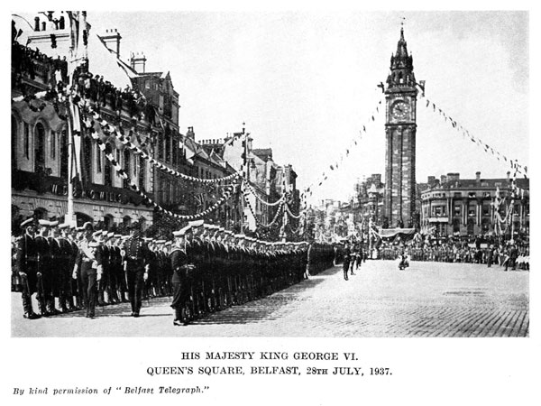
Seventy two years later, there was another Royal landing at the same spot, when King George V and Queen Mary visited Belfast, then a city, on 22nd June, 1921, to be followed sixteen years later by the visit of George VI and Queen Elizabeth on 28th July, 1937.